
MS8200-IDH Dual-Transducer Multibeam Echo Sounder:
Ultra-Wide Swath 3D Seabed Mapping Solution
Project Background
As global awareness of marine environmental protection and sustainable ocean resource management continues to grow, the demand for accurate and reliable marine geospatial data is increasing rapidly.
Marine environmental research, ocean resource exploration, hydrographic surveying, offshore engineering, and underwater infrastructure development all rely on high-quality bathymetric and seabed topographic data.
According to the International Hydrographic Organization (IHO), hydrographic surveying and marine geospatial data play an important role in supporting safe navigation, marine development, environmental management, and the sustainable use of ocean resources.
Among modern hydrographic survey technologies, multibeam echo sounders (MBES) have become one of the key technologies for acquiring high-resolution underwater terrain information.
A multibeam echo sounder uses acoustic signals transmitted and received underwater to detect the seabed across a wide swath. When integrated with high-precision sound velocity measurement, motion sensing, and positioning systems, the collected data can be processed to generate detailed three-dimensional representations of underwater terrain.
These 3D seabed models provide essential geospatial data for a wide range of applications, including:
- Marine environmental monitoring
- Hydrographic and bathymetric surveying
- Ocean resource exploration
- Seabed topographic mapping
- Port and harbor construction
- Offshore engineering
- Subsea infrastructure planning
- Marine geological research
- Dredging and underwater construction
- Coastal and offshore environmental assessment
As survey areas become larger and project requirements become more demanding, survey efficiency and coverage have become increasingly important. This has created a growing need for multibeam systems capable of achieving wider swath coverage while maintaining reliable bathymetric data quality.
Understanding Multibeam Echo Sounding Technology
Traditional 3D underwater terrain surveys commonly use a multibeam echo sounder equipped with a single transducer array.
During a survey, the transducer emits multiple acoustic beams across the seabed. The central beams generally provide strong and reliable echo returns. Однако, as the beam angle increases toward the outer edges of the swath, the effective array aperture decreases and the acoustic signal quality can deteriorate significantly.
This reduction in edge-beam performance can affect:
- Detection reliability
- Measurement accuracy
- Point density
- Data quality at the outer swath
- Effective survey coverage
As a result, the practical effective coverage of conventional single-transducer multibeam systems may be limited to approximately 4–в 6 раз больше глубины воды, depending on seabed conditions, acoustic characteristics, survey requirements, and environmental factors.
For large-scale bathymetric mapping projects, limited swath coverage can significantly increase survey time and operational costs.
Global bathymetric mapping initiatives such as GEBCO – General Bathymetric Chart of the Oceans demonstrate the importance of accurate seabed topographic data for understanding and mapping the world’s oceans.
This creates a key challenge for modern hydrographic surveying:
How can survey coverage be significantly increased while maintaining reliable seabed detection and high-quality bathymetric data?
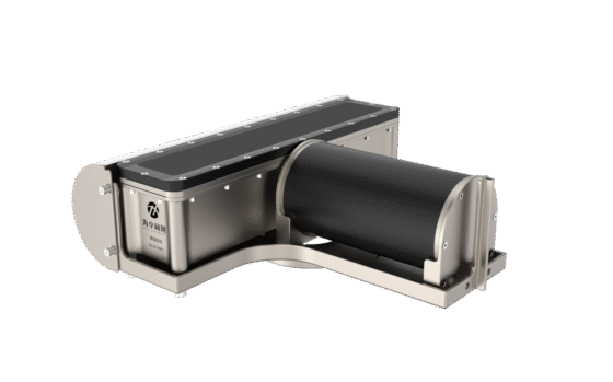
To address this challenge, we developed the MS8200-IDH dual-transducer multibeam echo sounding system, based on a V-shaped dual-transducer configuration.
MS8200-IDH Dual-Transducer Multibeam Echo Sounding System
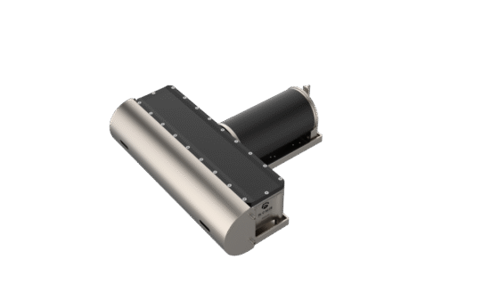
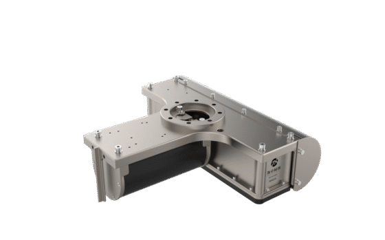
The MS8200-IDH adopts a V-shaped dual-transducer multibeam measurement configuration designed to expand effective survey coverage.
The system integrates two MS8200 multibeam echo sounders with high-precision sound velocity measurement, inertial navigation, positioning, and hydrographic survey software.
By combining the coverage areas of two transducers, the system is designed to achieve an approximately 10× water-depth swath coverage, significantly improving survey efficiency compared with conventional single-transducer configurations.
The dual-transducer architecture provides an effective solution for large-area underwater topographic surveys where wide coverage and operational efficiency are critical.
The system can be configured as an integrated hydrographic survey platform combining:
- Dual multibeam echo sounding
- High-precision sound velocity measurement
- Inertial navigation and motion compensation
- Positioning and navigation
- Real-time survey data acquisition
- Hydrographic survey visualization
- Multibeam data processing
- Post-processing and 3D seabed modeling
This integrated architecture helps streamline the entire workflow from field data acquisition to final seabed terrain reconstruction.
For users working with large-scale marine datasets, Esri ArcGIS Bathymetry also provides specialized GIS-based tools and workflows for managing, visualizing, and analyzing bathymetric information.
System Composition
The MS8200-IDH dual-transducer multibeam echo sounding system consists of the following major components:
1. MS8200 Multibeam Echo Sounder × 2
Two MS8200 multibeam echo sounders form the core of the dual-transducer measurement architecture.
The V-shaped configuration enables simultaneous acoustic measurement across a significantly wider area, helping improve survey efficiency for large-scale underwater terrain mapping.
2. POS Inertial Navigation System × 1
The POS inertial navigation system provides high-precision motion and attitude information required for accurate multibeam data processing.
It compensates for vessel motion, including:
- Roll
- Pitch
- Heave
- Heading
Accurate motion compensation is essential for maintaining the spatial accuracy of bathymetric measurements, particularly in dynamic marine environments.
3. SVS1500 Sound Velocity Sensor × 1
The SVS1500 sound velocity sensor provides real-time sound velocity information near the transducer.
Sound velocity is an important parameter in multibeam surveying because variations in acoustic propagation speed can influence beam steering and range calculations.
4. SVP1500 Sound Velocity Profiler × 1
The SVP1500 is used to measure the sound velocity profile throughout the water column.
Accurate sound velocity profiling helps improve acoustic ray-tracing calculations and contributes to reliable bathymetric data quality.
5. HydroQuest 2024 Display & Control Software
The display and control software provides an operational interface for system monitoring, parameter configuration, and survey visualization.
6. HydroNavi Survey & Data Acquisition Software
HydroNavi provides survey planning, navigation, real-time data acquisition, and survey monitoring functions.
7. Multibeam Post-Processing Software
The post-processing software is used to process and analyze acquired multibeam data, enabling users to generate high-quality bathymetric datasets and 3D seabed terrain models.
8. UPS Power Supply
The UPS power supply provides stable power protection for the integrated survey system and helps maintain operational continuity during field surveys.
9. Tide Gauge × 1
Tide measurements can be used to support vertical datum correction and improve the accuracy of bathymetric survey results where tidal variation is a significant factor.
10. Robust Mounting Pole × 1
The robust mounting pole provides a stable mounting structure for the transducer assembly and is designed to support reliable operation in demanding marine survey environments.
Key Technology Breakthroughs
The MS8200-IDH system incorporates several technical innovations designed to address the challenges associated with wide-swath and dual-transducer multibeam surveying.
1. Coherent Depth Sounding Technology
When a multibeam transducer is installed at an angle, detecting outer echoes can become more challenging.
The MS8200-IDH applies coherent depth sounding technology to improve the detection capability of outer beams under tilted-transducer operating conditions.
This technology helps address the challenges associated with:
- Tilted transducer installation
- Outer-beam echo detection
- Wide-angle acoustic measurement
- Weak or unstable edge echoes
The result is improved reliability in wide-swath bathymetric data acquisition.
2. Secondary Echo Suppression and Surface Interference Reduction
Dual-transducer multibeam surveying can introduce additional acoustic interference and secondary echoes, particularly in shallow-water environments.
The system uses optimized signal-processing algorithms to identify and suppress secondary echoes and reduce remote surface interference.
This helps improve the reliability of seabed detection and data quality during shallow-water dual-transducer operations.
The technology is particularly important when operating in environments where acoustic reflections from the water surface or other interfaces may affect seabed detection.
3. Enhanced Edge-Beam Energy Density
The quality of outer beams is one of the major factors limiting the effective swath width of conventional multibeam systems.
The MS8200-IDH enhances the energy density of edge beams to improve acoustic signal strength and detection capability at the outer edges of the survey swath.
This approach helps address challenges associated with:
- Weak edge-beam signals
- Long-range seabed detection
- Deep-water surveying
- Ultra-wide swath measurement
By improving edge-beam performance, the system can support wider survey coverage while maintaining reliable seabed detection.
4. Intelligent Terrain Tracking and Automatic Parameter Optimization
Survey conditions can change continuously as the vessel moves through areas with different water depths and seabed terrain.
The MS8200-IDH optimizes algorithms for terrain tracking and automatic operating parameter adjustment, particularly under tilted-transducer operating conditions.
This enables the system to dynamically adapt survey parameters according to changing underwater terrain and operating conditions.
The benefits include:
- More efficient survey operations
- Improved adaptation to changing water depths
- Reduced manual parameter adjustment
- Better operational consistency
- Improved efficiency during large-area surveys
Ultra-Wide Swath Coverage for Efficient Seabed Mapping
One of the key advantages of the MS8200-IDH is its dual-transducer architecture.
Compared with conventional single-transducer multibeam configurations, the V-shaped dual-transducer system expands the effective survey coverage and can achieve approximately 10 times the water depth in swath coverage, depending on operating conditions and survey requirements.
For example, in large-scale bathymetric surveys, wider coverage can reduce the number of survey lines required to cover the same area.
This can potentially improve:
Survey Efficiency → Wider Coverage → Fewer Survey Lines → Reduced Survey Time → Lower Operational Costs
The system is therefore particularly suitable for projects where large areas need to be surveyed within limited operational windows.
For additional bathymetric data resources, users can explore EMODnet Bathymetry, which provides access to European marine bathymetric datasets and digital terrain models.
Typical Applications
The MS8200-IDH dual-transducer multibeam echo sounding system can be applied to a wide range of marine and underwater surveying projects.
Hydrographic Surveying
High-resolution bathymetric data acquisition for rivers, Озер, Водохранилищ, coastal waters, and offshore areas.
For international hydrographic surveying standards and industry guidance, professionals can refer to the International Hydrographic Organization (IHO).
Seabed Topographic Mapping
Generation of detailed 3D seabed terrain models for marine geological and environmental studies.
Global seabed mapping and bathymetric research can also be referenced through GEBCO and its global ocean bathymetry resources.
Port and Harbor Surveying
Supporting port construction, expansion, dredging, navigation channel maintenance, and underwater infrastructure planning.
Offshore Engineering
Providing bathymetric information for offshore wind farms, subsea pipelines, cables, and other marine engineering projects.
Marine Resource Exploration
Supporting the investigation and assessment of underwater geological and marine resources.
Dredging and Channel Management
Providing accurate seabed elevation data for dredging planning, volume calculations, and post-dredging verification.
Marine Environmental Monitoring
Supporting long-term monitoring of seabed changes, sediment movement, coastal erosion, and underwater environmental conditions.
The UNESCO Intergovernmental Oceanographic Commission (IOC) also provides international resources related to ocean science, marine research, and ocean data cooperation.
International Marine Surveying and Ocean Engineering Resources
The development of modern multibeam and hydrographic surveying technologies is closely connected with international cooperation in ocean science, hydrography, marine engineering, and underwater technology.
The following professional organizations and data resources provide additional information relevant to marine surveying and underwater mapping:
- International Hydrographic Organization (IHO) – International hydrographic standards and marine geospatial resources.
- GEBCO – General Bathymetric Chart of the Oceans – Global ocean bathymetry and seabed mapping resources.
- EMODnet Bathymetry – European marine bathymetric data and digital terrain models.
- NOAA Office of Coast Survey – U.S. hydrographic surveying, nautical charts, and coastal mapping resources.
- NOAA National Centers for Environmental Information (NCEI) – Oceanographic, environmental, and geophysical data resources.
- Esri ArcGIS Bathymetry – GIS-based bathymetric data management, visualization, and analysis.
- UNESCO Intergovernmental Oceanographic Commission (IOC) – International ocean science and marine data resources.
- International Federation of Hydrographic Societies (IFHS) – Professional resources related to hydrography and marine surveying.
- IEEE Oceanic Engineering Society – Resources covering ocean engineering, underwater technology, marine systems, and related research.
- GEBCO – About Our Work – International initiatives and activities related to global ocean bathymetry and seabed mapping.
Conclusion
The rapid development of marine engineering, Мониторинг окружающей среды, and ocean resource management has created an increasing demand for high-efficiency, high-precision underwater 3D mapping technologies.
Traditional single-transducer multibeam systems can face limitations in edge-beam performance and effective swath coverage, particularly when large-scale underwater terrain mapping is required.
The MS8200-IDH dual-transducer multibeam echo sounding system addresses these challenges through a V-shaped dual-transducer architecture combined with advanced acoustic processing, high-precision motion compensation, sound velocity measurement, positioning, and integrated hydrographic survey software.
With approximately 10× water-depth swath coverage, optimized edge-beam detection, secondary echo suppression, and intelligent terrain tracking, the system provides an efficient solution for wide-area bathymetric and seabed topographic surveys.
By integrating multibeam echo sounding, inertial navigation, sound velocity measurement, data acquisition, and post-processing into a unified survey workflow, the MS8200-IDH is designed to support the next generation of efficient marine surveying and underwater 3D terrain mapping.
For large-scale hydrographic surveys, offshore engineering, Картографирование морского дна, and marine environmental monitoring, wide-swath dual-transducer multibeam technology provides a powerful approach to improving survey efficiency and expanding underwater data acquisition capabilities.
Questions about MS8200-IDH
1. How does MS8200-IDH reach 10 times the wide sweep width?
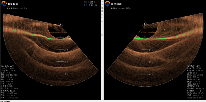
For the shallow water environment, the key factors that determine the coverage width are mainly the influence of edge beam width and reverse grazing angle. Due to the V-shaped array of dual heads, comparing with the single head’s installation mode directly toward seabed, the angular resolution of the edge beam angle is obtained. This is a huge improvement, shrinking by 4 times at 80 degrees, effectively reducing the edge beam footprint. According to actual survey, the effective swath reaches about 100 meters when the water depth is 10m.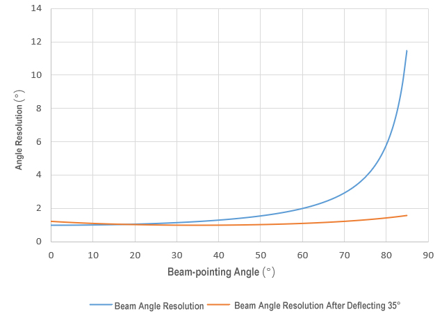 、
、
Example 1:
In the survey area, the water depth is 8.31 meters, the single-side scanning width is 57 meters, the coverage width of a single survey line of the dual heads is 114 meters, and the scanning width can reach 13.71 times of depth;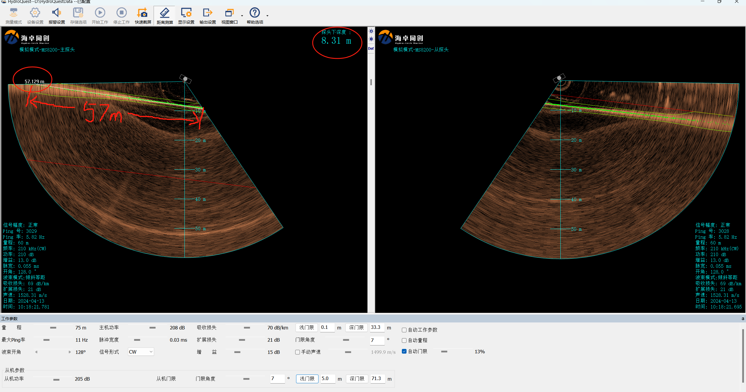
Example 2:
In the survey area, the depth is 12.43 meters, the single-side scanning width is 71.47 meters, and the swath of a single survey line of the dual heads is 142.94 meters, which can reach 11.5 times of depth;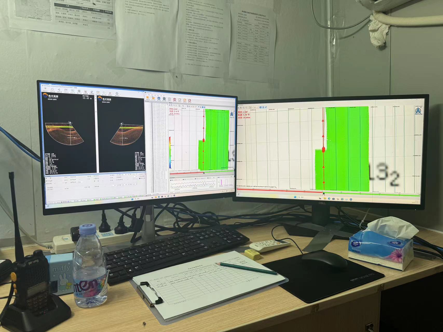
2. How about the data quality?
Taking the above [Example 2], we conduct and compare the edge data analysis, data stitching analysis, and comparative analysis of main and test line accuracy.
Edge Data Analysis:
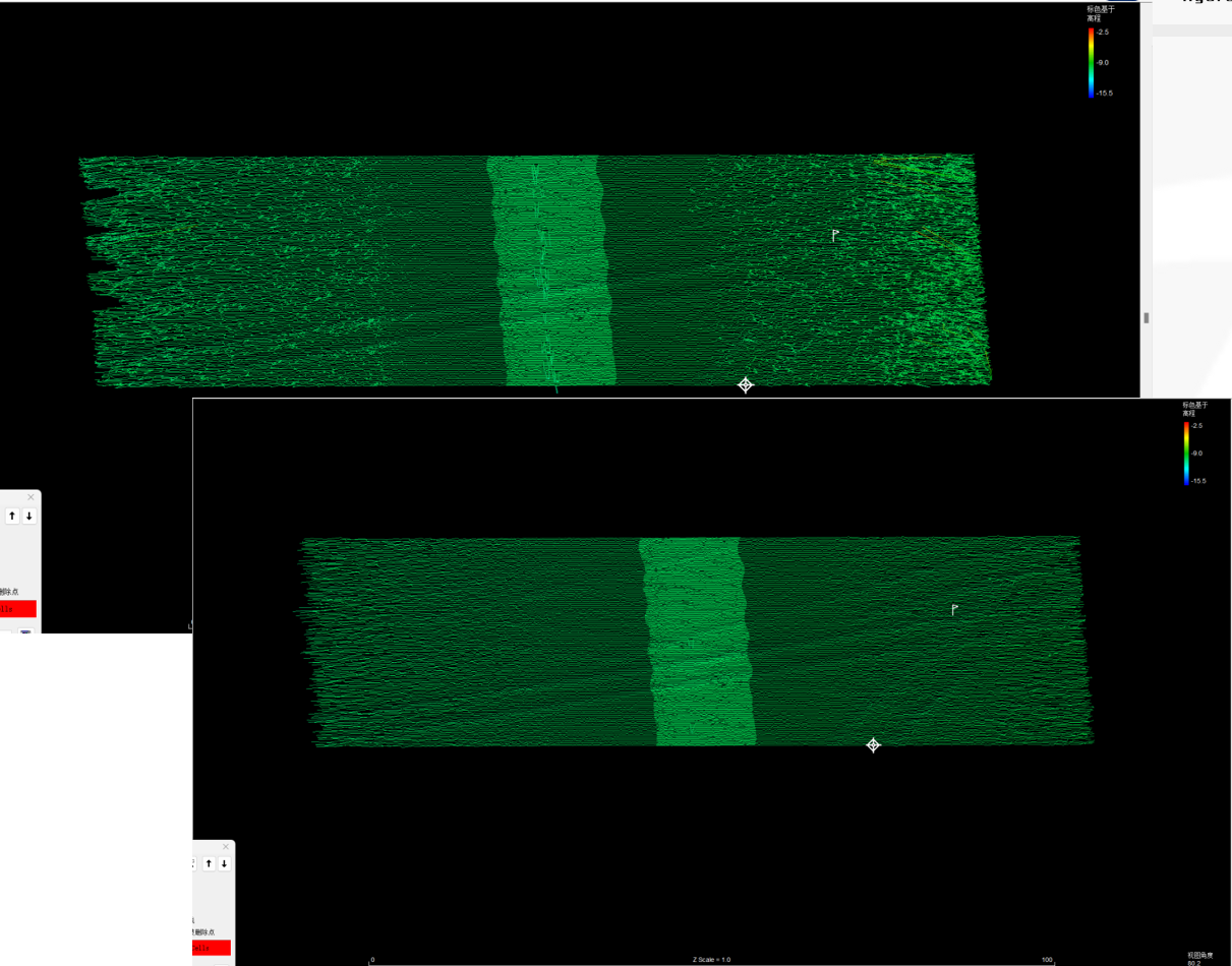
- There are some bright noises at the edgebeams of the dual heads, which can be quickly and automatically removed through the software filtering function, without the need to manually remove outliers;
- After statistics, the number of highlighted noise points accounts for 2.67% of the total measurement points, and the proportion of consistent points is 97.33%, which complies with the “IHO Hydrographic Survey Specification S-44” and the survey technical requirements of the multibeam bathymetry system.

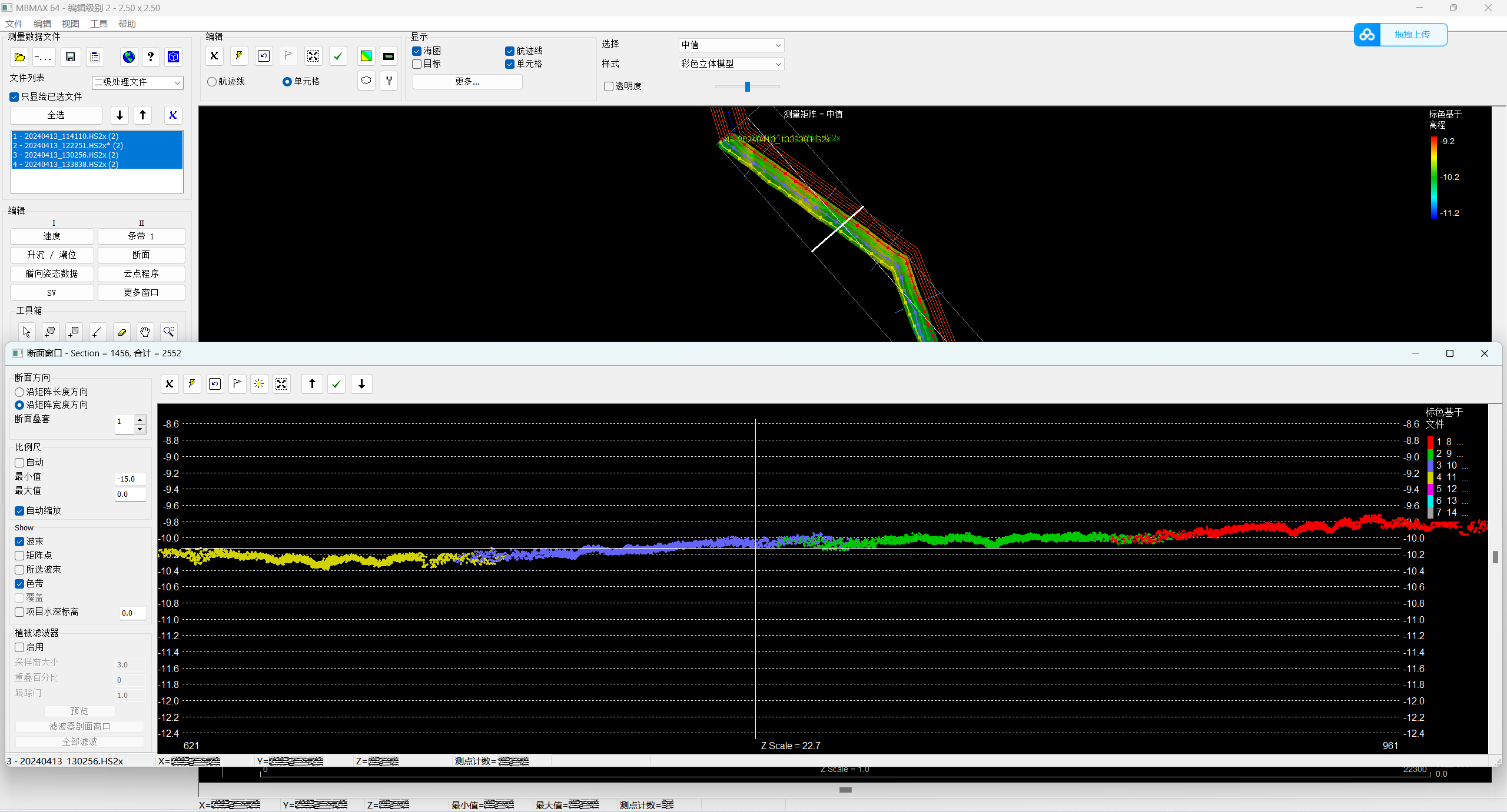
Data Stitching Analysis:
The data of the dual heads can be completely stitched together, and so does the overlapping part can match together too; The cross-sectional of different areas all can be spliced together;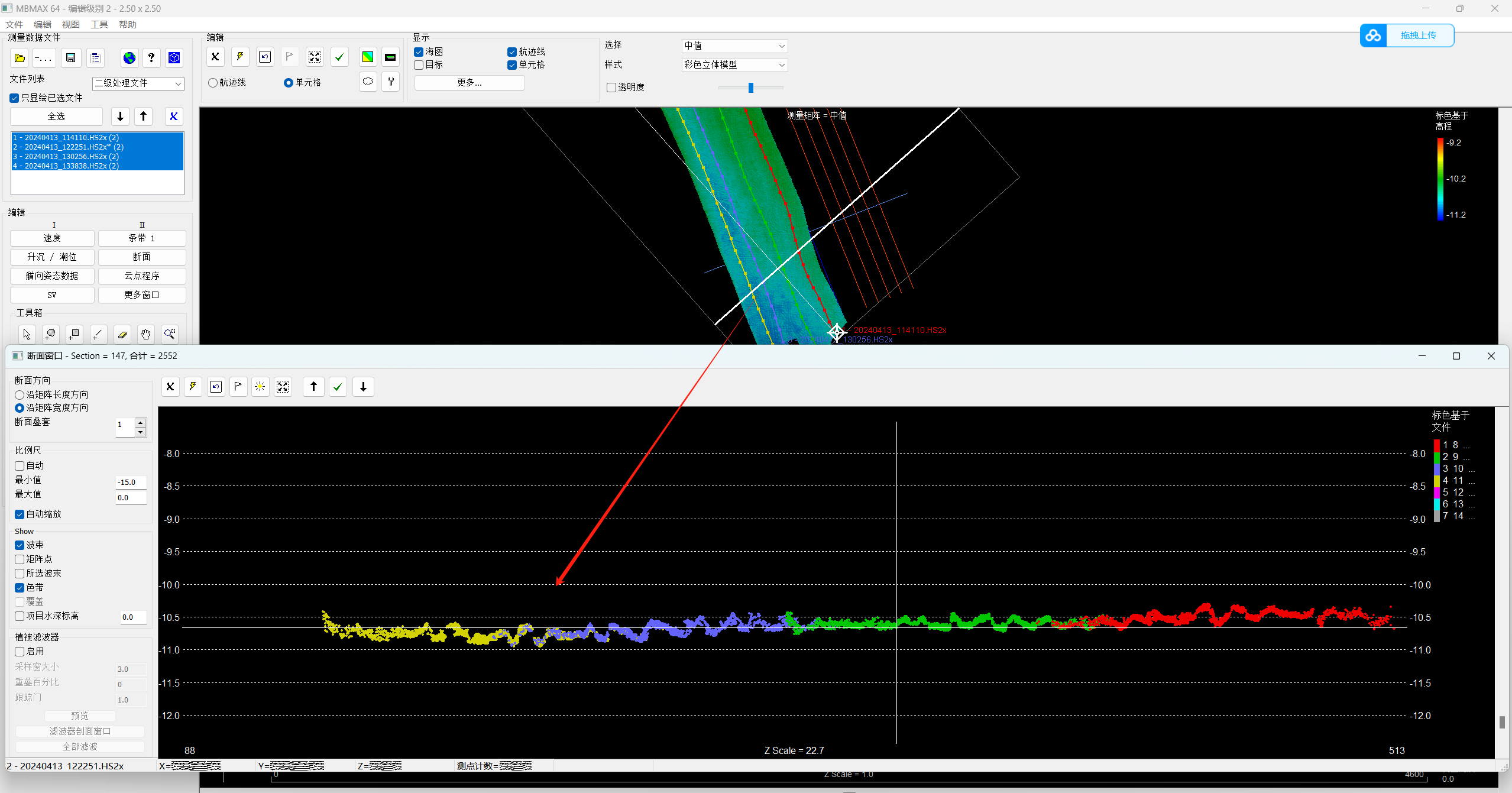
Comparative analysis of main and test line accuracy:
- The data used for main inspection comparison is from left angle 78°, right angle 79°, and coverage width 134.2 meters, which is 10.8 times of the depth;
- Create TIN models for two sets of multibeam data results, and perform difference processing on the TIN models. Blue is the main survey line and red is the inspection line area. The renderings and range of the two sets of multi-beam data results are as follows:
- Perform difference analysis on data within the range of 1m*1m, as shown in the figure above:
- Perform statistical analysis on all different data, and the difference distribution is uniform and consistent with the normal distribution law as shown in the figure:
After statistics, the proportion of error values less than or equal to ±0.2 meters accounted for 98.7%, which is better than the regulation requirements.
3. How much better is the MS8200-IDH dual head compared to the single head?
Through the analysis of the effective swath of multi-beams, it is shown that the survey efficiency of dual head has been significantly improved comparing to a single head. Однако, how much can it actually be improved and how much human and material costs can be saved, these two questions can be answered through a set of test data: Single/Dual head test comparison in 10m deep water.
- Four survey lines of continuous dual-head multibeam data in the depth of about 10 meters water, which aresurveyed from 11:31 Кому 14:46, taking 3 hours and 15 minutes, and the average speed was 5.5 knots (10.29km/h)

- Survey Line: 26.139km

- Survey Area: 2.47km²
- After the dual heads survey is completed, a single head surveyed in the same water area. In order to ensure the accuracy of the test results, the vessel, test personnel, auxiliary equipment, ship speed, и так далее. are all same as the dual head. After surveying and mapping, the swath of a single survey line with a single head is about 40m, mapped 2.47km² sea area, the survey time is 6.67h, and the total length of the survey line is 65.12km.
- By comparing the measurement data of single/dual heads in the same water area, while ensuring that other factors remain unchanged, the survey time of the dual heads is shortened by 52.77%, and the total length of the survey line is reduced by 59.86%.

- Four survey lines of continuous dual-head multibeam data in the depth of about 10 meters water, which aresurveyed from 11:31 Кому 14:46, taking 3 hours and 15 minutes, and the average speed was 5.5 knots (10.29km/h)

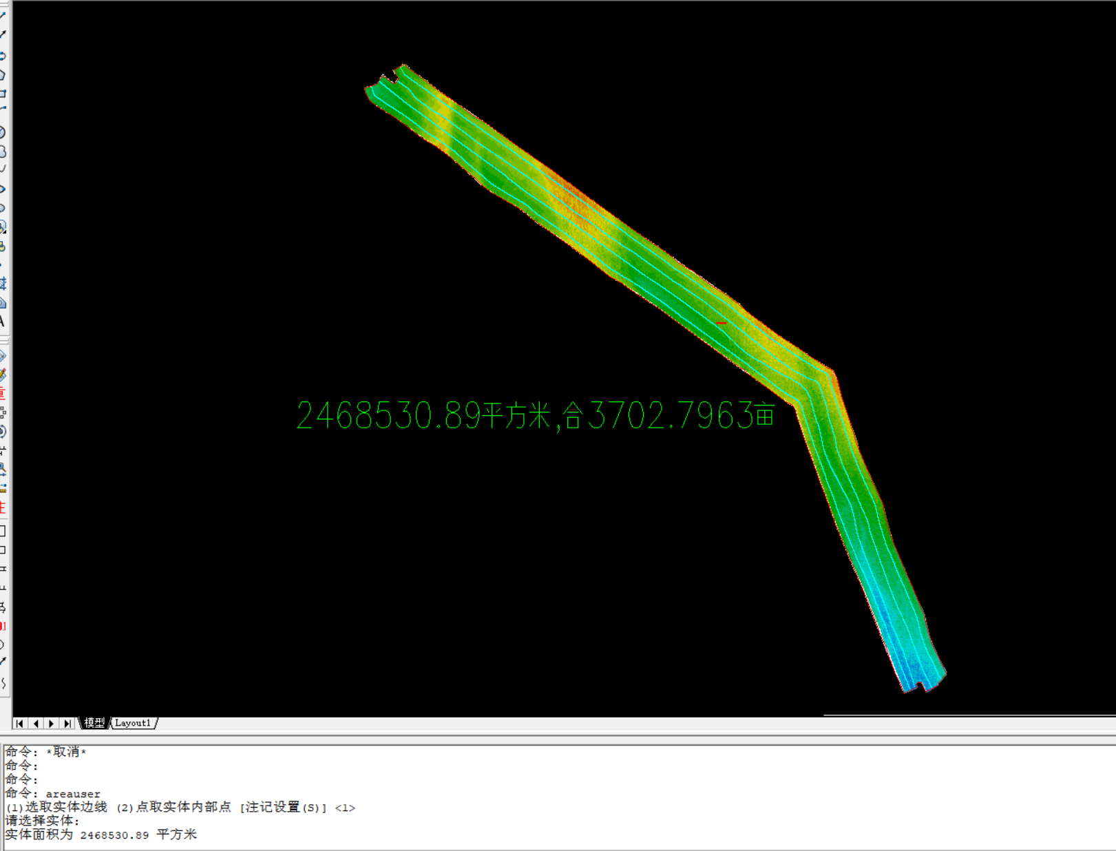

【Example】
For a oceanology surveying and mapping project, the water depth is about 20 meters, the planned survey area is 600km², and the client estimates that the operation time will be 30 days. After our engineer communicated to the client and checked the environment, we reached a consensus and decided to use MS8200- IDH dual heads multibeam echo sounder to carry out the survey. In the end, it took 15.5 days to complete the planned survey mission. The total length of the survey line was 3700km, saving nearly 50% of the time for users to complete the project, truly get twice the result with half the effort. MS8200-IDH received favorable comments from our clients.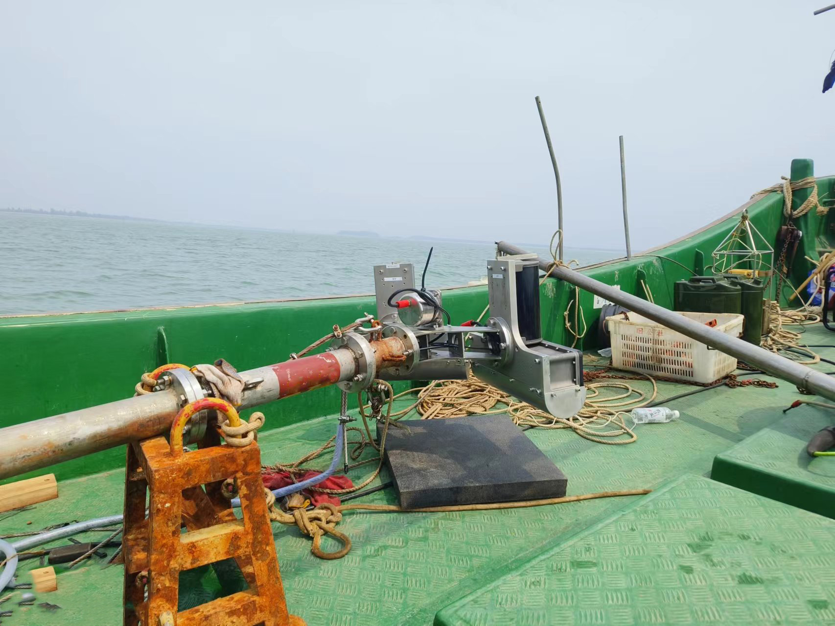
Through the analysis of the swath, data and actual survey efficiency of the dual heads, the MS8200-IDH has nearly doubled the efficiency in large-area ocean surveying and mapping, saving more than 50% of operating time and investment costs.